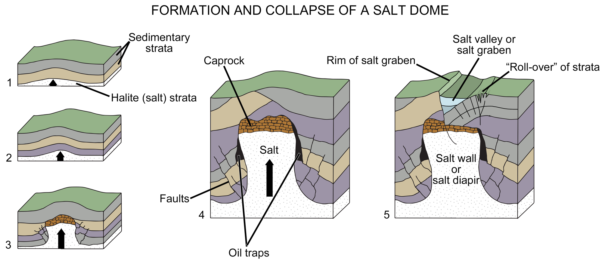

Weeks and Eargle reported in 1960 that one of the most unusual uranium deposits discovered in recent years is in Pliocene sediments above the caprock of Palangana salt dome, in Duval County, Texas.
 Source:https://earthathome.org/hoe/sw/energy-cp/
Palangana is in the Coastal Plain, about 70 miles west of the Gulf of Mexico and 100 miles north of the Rio Grande. The salt dome was discovered in 1916; sulfur was produced from the caprock in the 1920's and early 1930"s, and during the same period a few thousand barrels of oil was produced from shallow sands above the caprock (Barton, 1925). At present brine is being produced by the Columbia, Southern Chemical Company, and it was this company that discovered the uranium by gamma-ray logging of holes drilled in a search for potassium.
The surface expression of Palangana salt dome is a shallow basin in a brush-covered plain that slopes eastward about 20 feet per mile and is capped with a nearly continuous layer of caliche. The dome is covered by the Goliad sand (Pliocene), which dips 25 to 40 feet per mile east-southeastward and overlaps middle Tertiary rocks (Sayre, 1937) (fig. 24.1). The Goliad sand overlaps unconformably on the Lagnrto clay (Miocene?), which is dominantly an impermeable clay, with a few sand lenses, on the Oakville sandstone (Miocene) a massive sand with some gravel, clay balls and ashy clay, and on the Catahoula tuff (Miocene ?), which contains highly tuffaceous sand and clay and volcanic conglomerate (Sayre, 1937), and on the Frio clay (Oligocene?), which is dominantly clay and relatively impermeable.
Most of the Tertiary sediments, but especially the Catahoula tuff, contain large quantities of volcanic detritus, pebbles, sand grains of igneous minerals, and shards of glass. The most abundant rock types are chiefly andesite, trachyandesite, and soda trachyte (Bailey, 1926). The outcropping rocks of the Catahoula are slightly to considerably altered by alkaline ground water, which caused the development of a caliche cover, opal, and chalcedony cements, and formation of zeolites. The most likely sources of the Catahoula sediments appenr to be the igneous rocks of Mexico, 100 miles or more to the west, or those of the Big Bend country, 300 miles northwest.
Recent analyses of a suite of the Big Bend rocks indicate they contain more than avernge quantities of uranium (David Gottfried, written communication, 1959). The salt of the Palangana dome is 850 to 1,000 feet below the surface (fig. 24.1). It is capped by anhydrite, gypsum, sulfur, and carbonate rock several hundred feet in total thickness.
The uranium ore, chiefly very fine grained sooty pitchblende, occurs at a depth of about. 325 feet, more than 100 feet above !he caprock. It is in highly calcareous clay-ball conglomerate interbedded with friable fine- to medium-grained sand locally impregnated with a little oil. Only a few beds are firmly cemented. The conglomerate contains black chert pebbles, nodular authigenic chalcedony, a little partly silicified fossil wood, and a few vertebrate fossils. Several horse teelh and a dog tooth found by company personnel and by us were identified by Prof. J. A. Wilson, of the University of Texas, as belonging to the fauna of the basal member of the Goliad sand.
Managed by I2M Consulting, LLC
